Posties Park Dumbarton
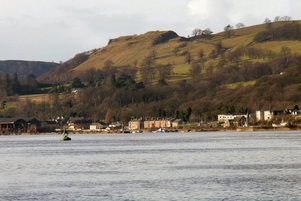
- a Victory for the People. The council meeting to decide on the site for the proposed new Our Lady and St Patrick’s school was held on Wednesday 8th January. Posties Park, currently zoned as open space, is to the seaward side of Levengrove Park and was the site being promoted as the most suitable by Terry Lannigan, Executive Director of Educational Services and the council’s advisory team. This was being opposed by many including a ‘Save Posties Park’ campaign group
A statutory consultation had been held to which there had been 515 responses, 149 recommending Posties Park, 185 the current school site on Cardross Road and 176 for other sites. Feeling in Dumbarton on the possibility of losing this public park was running high.
Clydebelt had objected to the choice of Posties Park mostly on the grounds of loss of very valued open green space and being contrary to the Local Plan in several aspects.
The committee meeting was held in the Denny Theatre as it was anticipated that there would be a large attendance. The theatre was full (350) seats. Protesters had many banners and placards. The Director of Education spoke, through some noisy interjections, as to how this was the preferred site and no others would be as suitable. Cllr David McBride (Labour) motioned, with a very reasoned speech, for a refusal of acceptance of this choice of site. Cllr Jonathon McColl (SNP group leader) seconded the motion and it was obvious then that the case for the Posties Park objectors was won. The meeting ended with much cheering and jubilation among most of the audience. Unanimous decision and unexpected as most thought the ruling Labour group were going to support their Education Director. A victory also for reason and democracy.
Rose Harvey, who was prominent in the Save Posties Park campaign, is a committee member of Clydebelt and, with many others, put considerable time and effort into this highly successful campaign. Well done Rose and the others who showed the WDC councillors that people do value their green spaces.
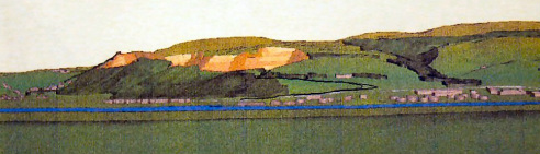
Forest Design Plan for the Kilpatrick Hills.
Forestry Commission Scotland will be hosting community consultations in January 2014 to gain feedback on their draft Forest Design Plan which covers their existing plantations and the ground more recently acquired.
The venues, dates and times where these sessions will be held are listed below:
* Clydebank Shopping Centre, Sylvania Way, Clydebank, (old BHS café space) Saturday 18th January, 10am - 4pm
* Edenmill Farm Shop, Blanefield, Glasgow, G63 9AX, Sunday 19th January, 12 noon - 4pm
* Napier Hall, Dumbarton Road, Old Kilpatrick, G60 5JH, Tuesday 21st January, 4pm- 7.30pm
* Artizan Centre, Dumbarton, G82 1LJ, Saturday 25th January, 10am-4pm
They are keen to encourage the local community, groups, individuals, businesses and anyone with an interest in this site to contribute towards this process so please pass this information on to other people you think might be interested in attending.
You can download a Summary of the Proposals by the following button:
- a Victory for the People. The council meeting to decide on the site for the proposed new Our Lady and St Patrick’s school was held on Wednesday 8th January. Posties Park, currently zoned as open space, is to the seaward side of Levengrove Park and was the site being promoted as the most suitable by Terry Lannigan, Executive Director of Educational Services and the council’s advisory team. This was being opposed by many including a ‘Save Posties Park’ campaign group
A statutory consultation had been held to which there had been 515 responses, 149 recommending Posties Park, 185 the current school site on Cardross Road and 176 for other sites. Feeling in Dumbarton on the possibility of losing this public park was running high.
Clydebelt had objected to the choice of Posties Park mostly on the grounds of loss of very valued open green space and being contrary to the Local Plan in several aspects.
The committee meeting was held in the Denny Theatre as it was anticipated that there would be a large attendance. The theatre was full (350) seats. Protesters had many banners and placards. The Director of Education spoke, through some noisy interjections, as to how this was the preferred site and no others would be as suitable. Cllr David McBride (Labour) motioned, with a very reasoned speech, for a refusal of acceptance of this choice of site. Cllr Jonathon McColl (SNP group leader) seconded the motion and it was obvious then that the case for the Posties Park objectors was won. The meeting ended with much cheering and jubilation among most of the audience. Unanimous decision and unexpected as most thought the ruling Labour group were going to support their Education Director. A victory also for reason and democracy.
Rose Harvey, who was prominent in the Save Posties Park campaign, is a committee member of Clydebelt and, with many others, put considerable time and effort into this highly successful campaign. Well done Rose and the others who showed the WDC councillors that people do value their green spaces.
Forest Design Plan for the Kilpatrick Hills.
Forestry Commission Scotland will be hosting community consultations in January 2014 to gain feedback on their draft Forest Design Plan which covers their existing plantations and the ground more recently acquired.
The venues, dates and times where these sessions will be held are listed below:
* Clydebank Shopping Centre, Sylvania Way, Clydebank, (old BHS café space) Saturday 18th January, 10am - 4pm
* Edenmill Farm Shop, Blanefield, Glasgow, G63 9AX, Sunday 19th January, 12 noon - 4pm
* Napier Hall, Dumbarton Road, Old Kilpatrick, G60 5JH, Tuesday 21st January, 4pm- 7.30pm
* Artizan Centre, Dumbarton, G82 1LJ, Saturday 25th January, 10am-4pm
They are keen to encourage the local community, groups, individuals, businesses and anyone with an interest in this site to contribute towards this process so please pass this information on to other people you think might be interested in attending.
You can download a Summary of the Proposals by the following button:
| kilpatrick-hills-fdp_--summary-of-proposals.pdf |
We have attached a Summary of the Proposals and have on file a series of MAPS to accompany this but the file is too large to transmit to several recipients at a time. Will send individually on request. Titles are 1-Overview, 2-Potential Afforestration, 3-Potential Deforestration, 4-Roads & Quarries, 5a-Peat Depth Survey, 5b- Breeding Bird Survey, 5c-0pen habitat survey, 6-Sensitivities and 7-Qualifying Projects . The initial letter codes used in some of the maps legends are not explained and perhaps not understood by non- foresters. These will no doubt be on show and explained at the sessions above.
Contact is-- Eilidh Spence
Woodland Learning & Community Officer
Woodland Trust Scotland & Forestry Commission Scotland Lang Craigs & Kilpatrick Hills
Mobile: 07770430185
Sustrans Volunteers - be a Greener Greenways Champion
Sustrans has recently started an exciting new project in Scotland called ‘Greener Greenways’ to enhance and improve the biodiversity on traffic-free sections of the National Cycle Network, which act as wildlife corridors, linking habitats and species which would otherwise be isolated from each other. With funding from the Scottish Government and Scottish Natural Heritage, the project was launched in August 2013 and will initially run for three years, creating habitat management plans on 100km of Sustrans-managed greenways and over 100km of greenways managed by other organisations, such as local authorities. Volunteers will be trained in wildlife ID, surveying skills and habitat management, and will monitor and record wildlife on a local stretch of route. All that is needed is an interest in nature and enthusiasm!
Locally volunteers are required to monitor wildlife and collect data on the traffic-free route from Dalmuir along the canal and on to Milton in order to help improve and enhance biodiversity, and engage the public.
To find out more about becoming a Wildlife Champion, contact your Sustrans Scotland Volunteer Coordinator, Laura White: [email protected] Tel 0131 346 3016
http://www.sustrans.org.uk/volunteer/get-involved/vacancies/wildlife-champion-greener-greenways-dalmuir-milton
and/or
http://www.volunteerscotland.net/find-an-opportunity/opportunity-search/detail/?opportunityID=124661
W.D.C. Budget Meeting Consultation
Prior to the WDC’s Budget Meeting on February 6th there has been an online public box ticking consultation which runs to Friday 17th January. The Council require to make £17 Mn. savings by 2016/17, but this ‘consultation’ is only to access public opinion on achieving savings options of £189,000 in the current year. Without in depth knowledge of the implications of most of the cuts suggested we would have doubts as to the value of such ‘box ticking’ consultations.
The major concern for Clydebelt is the suggestion of reducing Dalmuir Golf course from 18 to 9 holes. What is not being said is that the intention is to sell off the remainder for housing, no doubt the real agenda being to lessen some of the of the £17 Mn. shortfall.
Clydebelt and others have petitioned at the last two local plan consultations to keep the Dalmuir wedge as green belt and to stop housing on it as was proposed twice, and failed, for Auchentoshan estate. The local plans evolve through a reasonably democratic consultation process and it seems that some elements in the council seem to think they can ignore them whenever they have new proposals. Posties Park being an example; saving the Dalmuir wedge could be the next public protest they might have to contend with. Or, could it be we’re being ‘wound up’ on this in order to accept some other cut elsewhere.
As regards the suggested cutting of some valuable council services to save £189.000, what will be final bill for the recent change to the Council’s Logo, hardly a priority in times of austerity, and, what do these surveys cost?
https://www.surveymonkey.com/s.aspx?sm=hcBs7VahZ8gUY35APzF6bQ%3d%3d
Clydebelt AGM and Membership Fees.
The AGM was relatively well attended as happens when there is a contentious issue. The evolving new WDC Local Development Plans intention to change the green belt designation to housing at Duntiglennan in Duntocher brought new faces to the meeting and several joined Clydebelt. The opinions put forward to the council on the plan will now be under consideration for presentation in the next stage towards the final plan.
The other main discussion was on membership fees. When Clydebelt was founded in 1990 a minimum of £1 per household was asked as a membership fee and no renewal fee has been asked since. We have been living on the large sum which was raised then by fund raising events and augmented by several donations and new memberships since. However we now need to raise some money and it was agreed that a minimum membership fee/donation of £5 per household will be implemented from January 1st. We cannot guarantee that your payment will last for 24 years this time. Some of those at the AGM have already paid. We will be investigating if there is a simple way to transfer money to Clydebelt’s account but meanwhile cheques made out to Clydebelt, with particulars and email if possible, can be sent to ELIZABETH PITTS, FAIRHILLS, STATION ROAD, OLD KILPATRICK G60 5LT
There were no new volunteers for the committee at the AGM. Anyone with an interest in protecting and improving the environment in around the Kilpatrick Hills and surrounding areas please come along to our meetings or get in touch.
Next Clydebelt Meeting Tuesday 21st January 7.30 in Trinity Church Hall, Roman Road, Duntocher.

 RSS Feed

